MASSIVE TERRAINOPEN. EXPLORE.MEASURE. DELIVER.
Bring the high-resolution terrain models, orthophotos, point clouds and CAD projects from your drone and LiDAR surveys together in a single desktop application.
Beta release — free, with every feature unlocked. Windows 10/11 (x64).
STREAM is not yet signed with a code-signing certificate, so Windows SmartScreen may show "Windows protected your PC". This does not mean anything was found in the file — Windows just doesn't recognize the publisher yet. To continue: More info → Run anyway.
Who Uses It
Why STREAM
GIGABYTES OF DATA.
ZERO WAITING.
Navigate Massive Terrain Without Lag
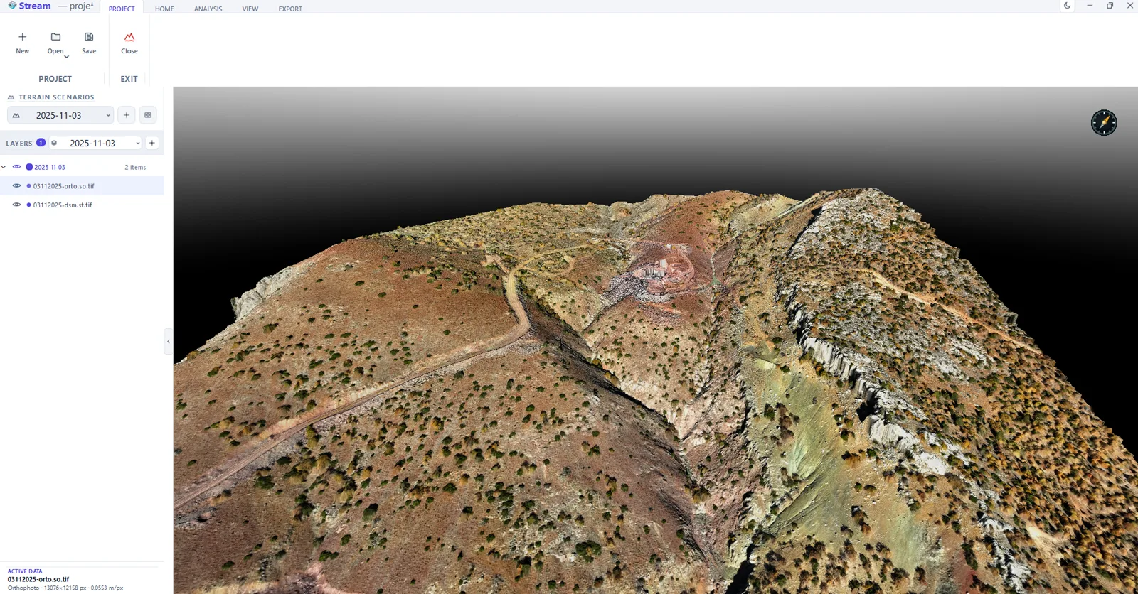
When you open DEMs and orthophotos that are hundreds of megabytes — even gigabytes — the program never stalls. Out-of-core terrain streaming loads only the area you're looking at in full detail.
Prepare Once, Always Open Fast
On first load STREAM converts your data to its own fast format. The next time you open the same data, it appears on screen within seconds.
All Your Field Data in One Place
View DEMs, orthophotos, point clouds and CAD drawings overlaid in the same scene — together with their coordinate system.
Automatic Terrain Model from Point Clouds
When you load a LAS/LAZ file, STREAM builds a clean terrain model from ground points, a surface model from all points, or an orthophoto.
Fully Offline, Fully Yours
Your data never goes to the cloud and needs no internet. Everything runs on your computer. Your sensitive project data stays safe.
Multilingual, Two Themes
Turkish, English, Spanish, French, Chinese and Russian interface. Light/dark theme and one-click metric/imperial unit switching.
Measure Stockpiles Instantly
Compute the volume and tonnage of material piles using a reference plane and material density; get a print-ready PDF report for mining, quarry and earthworks.
Compare Two Terrains Side by Side
With multi-screen (Split View) mode, view two terrain scenarios at once with a synchronized camera. Compare before/after or design/existing at a glance.
SCREENS
REAL SCREENS, REAL SITE
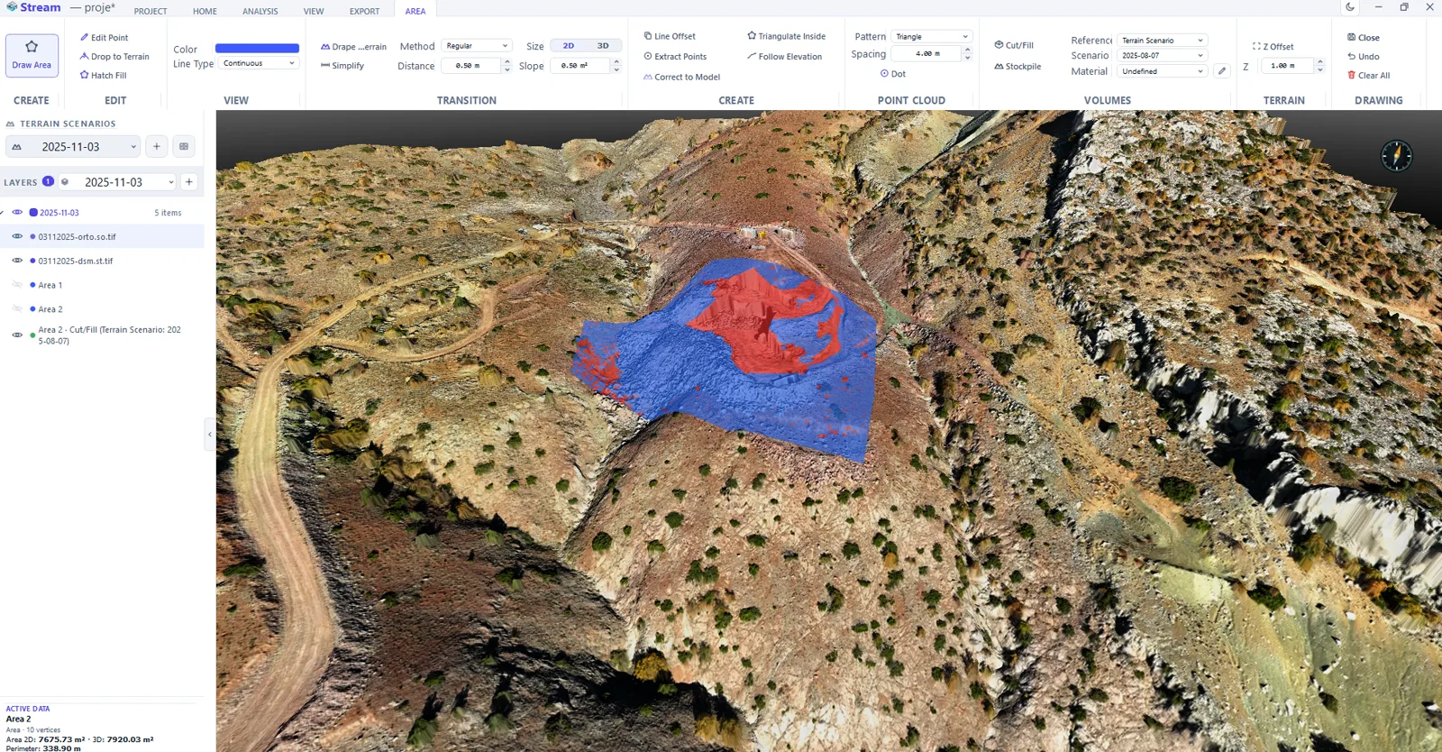
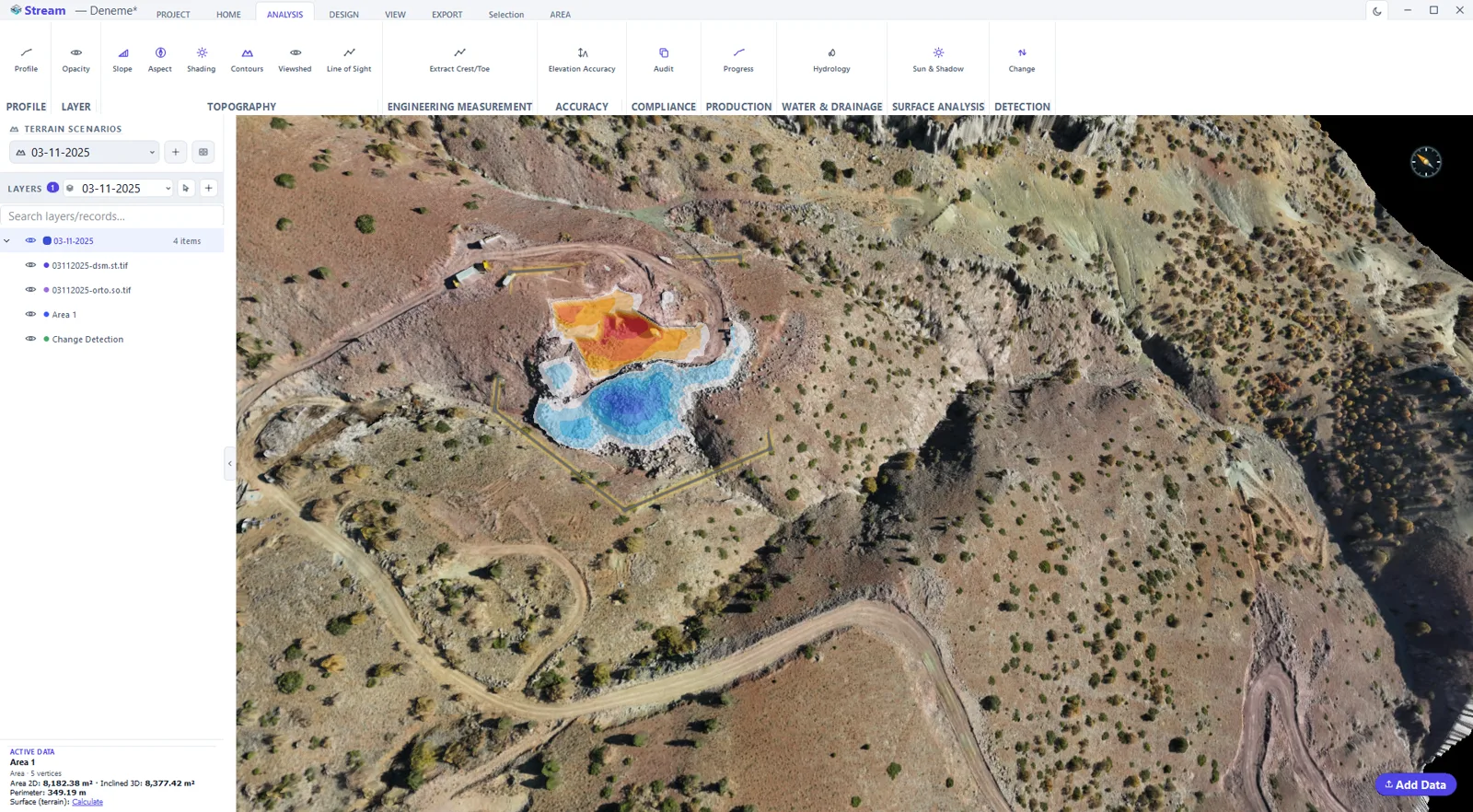
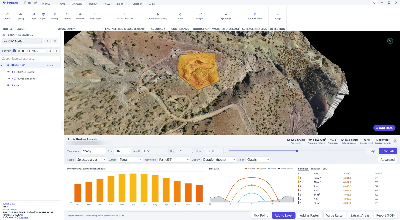
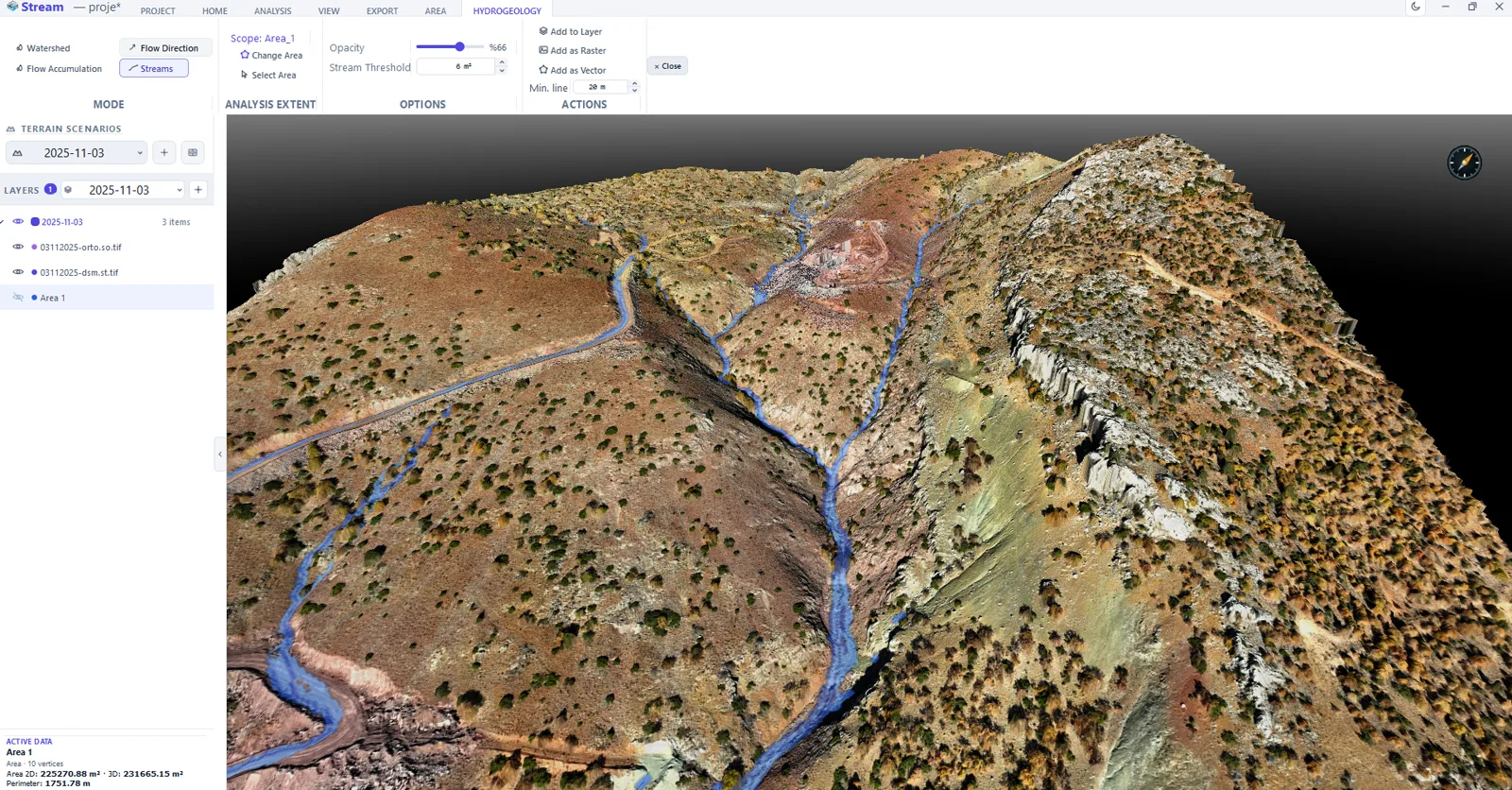
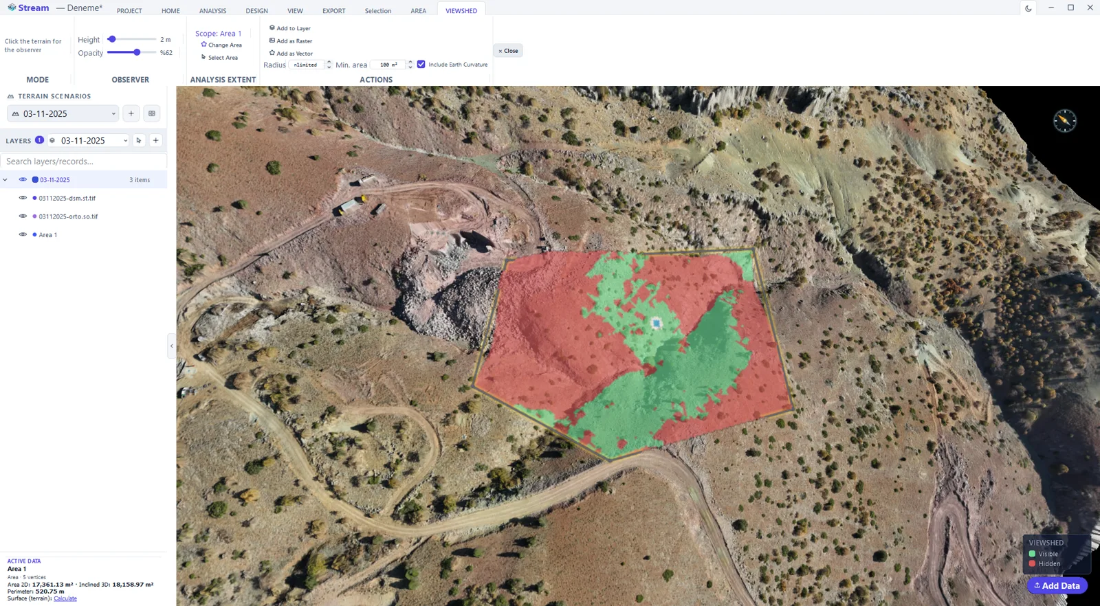
Every image below is the running product on a real drone survey — no mock-ups.
Tools
THE RIGHT TOOL FOR EVERY JOB
Distance Measurement
Real-world distance between two or more points
Elevation / Height Difference
Read the elevation difference between any two points instantly
Area Measurement
Surface area of closed regions, with instant on-screen results
Volume Calculation
Cut and fill quantities — against real terrain, a flat level or a comparative reference
Stockpile
Volume and tonnage of material piles — with reference plane and material type, PDF report
Terrain Analysis
MAKE SENSE
OF THE TERRAIN
STREAM doesn't just show the terrain — it makes sense of it. View analysis results as a live color layer over the terrain, and save them as raster or vector whenever you want.
- Slope, aspect and viewshed in one interface
- Hydrogeology and drainage analyses
- Customizable contour intervals
- Profile / cross-section lines
Supported Formats
WHATEVER THE FORMAT
Elevation Model & Orthophoto
Point Cloud
CAD Project File
Digital Elevation Model
Automatic Conversion from Point Clouds
When you load a LAS/LAZ file, STREAM offers you choices: a clean terrain model from ground points only, a surface model from all points, or an orthophoto if color is present. A raw point cloud turns into real terrain you can work on.
Export
DELIVERY-READY
OUTPUT
Turn everything you create into deliverable output. Files are written in standard formats; other GIS/CAD programs open them seamlessly.
Project Management
MANAGE YOUR SITE SCENARIOS
Multiple Terrain Scenarios
Manage and compare several scenarios of the same site, such as before/after excavation
Layer Tree
Organize all data and drawings in a tree, show/hide instantly with the eye icon
Coordinate Shift
Apply a reversible bulk datum shift across all outputs
Project File
Save your work and pick up later right where you left off
Cut/Fill Comparison
Select two terrain scenarios to compute the volume difference
Instant Unit Switching
Switch between metric and imperial in one click — all values convert instantly
VIDEOS
SEE STREAM IN ACTION
Watch short videos of STREAM at work — large terrain data, volumes, analysis and more.
Editions
THE EDITION THAT FITS YOU
To explore STREAM
- All features during beta
- No time limit
- Watermark-free export
- Community support
For professionals in the field
- All measurement & analysis tools
- Unlimited projects
- Watermark-free export (DXF / CSV / GeoTIFF)
- Offline license
- Priority support
For teams and organizations
- Multi-license management
- Remote license revocation
- Custom training & onboarding
- Dedicated support line
Academic use is always free — for researchers and universities, now and in the future.
Ask for an academic licence →Every plan runs fully offline — your data stays on your device. · System requirements
Manage your licence
When you change computer, release the old device here — the application cannot do that. You can also see your licence status, expiry date and the devices it is bound to. Accounts are created in the application; this page is sign-in only.
Sign in to my account →YOUR FIELD DATA,
FLUID TERRAIN ON YOUR DESKTOP.
No more loading gigabytes piece by piece, no more frozen programs, no more shuffling files between different tools. STREAM shows the terrain as it is.