HILLSHADE
Hillshade Software — Shaded Relief
STREAM is hillshade software that turns a plain DEM into readable terrain — shaded relief that simulates sunlight to make the shape of the ground pop. Adjust the sun position to emphasize the features you care about.
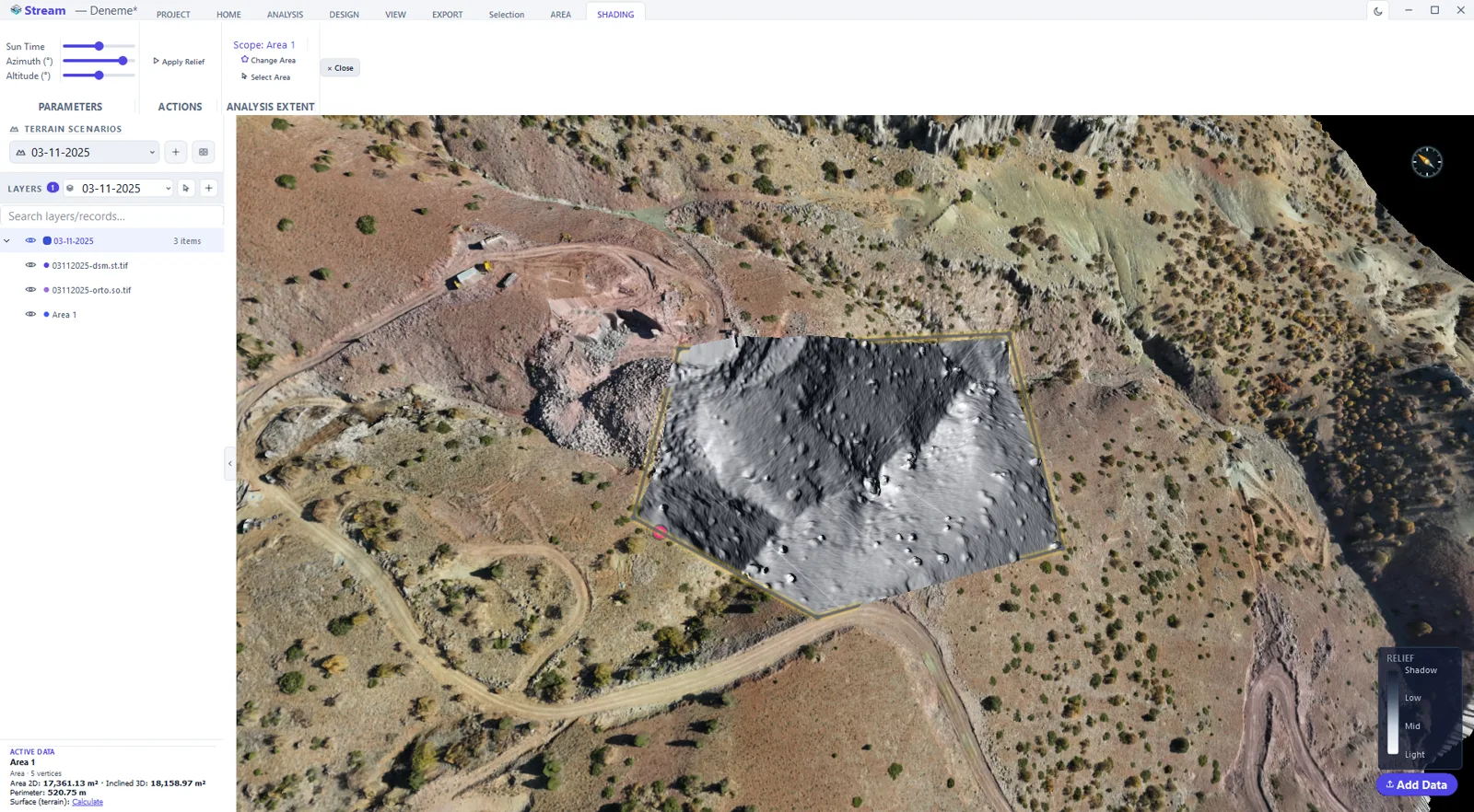
What is hillshade?
Hillshade, or shaded relief, computes how brightly simulated sunlight would fall on each part of the terrain given its slope and aspect. Slopes facing the light are bright; those facing away are shaded, producing an image the eye instantly reads as 3D.
It is a display technique that makes a DEM readable — distinct from sun-and-shadow analysis, which measures real sunlight hours over time.
Hillshade Software in STREAM
Shaded relief from the DEM
Generate a hillshade directly from the DEM to reveal ridges, valleys and subtle terrain features.
Adjustable sun position
Set the sun's direction and height to control how strongly relief is emphasized.
Combine with color
Blend hillshade with elevation colour or an orthophoto for a clear, map-ready view.
Part of the analysis suite
Sits alongside slope, aspect, contours and full sun & shadow analysis on the same DEM.
How to produce a hillshade from a DEM
- 1
Load the elevation model
Open the DEM the relief will be shaded from.
- 2
Set the light
Enter the azimuth and altitude of the light source. The conventional choice puts the light in the north-west so the relief does not read inverted.
- 3
Set the exaggeration
Raise the vertical exaggeration on gentle terrain so the landforms become visible, and keep it low on steep ground.
- 4
Read the terrain
The shaded relief makes ridges, gullies and benches legible at a glance — this is an interpretation and presentation layer, not a measurement.
- 5
Keep or export
Add the hillshade as a layer under your other data, or export it as a GeoTIFF for the map sheet.
Frequently asked questions
How does STREAM create hillshade?
STREAM computes shaded relief from the DEM by simulating sunlight based on each cell's slope and aspect, with an adjustable sun position.
Is hillshade the same as sun & shadow analysis?
No. Hillshade is a display technique that makes terrain readable; sun & shadow analysis measures actual sunlight hours over time including terrain shadow.
Can I combine hillshade with color?
Yes. Blend hillshade with elevation colour or an orthophoto for a clear, map-ready terrain view.
Where this is used
Try Hillshade in STREAM
Free beta for Windows x64. Works fully offline with GeoTIFF, LAS/LAZ and DXF.
Download STREAM free