DIGITAL ELEVATION MODEL
DEM Viewer and Software for Large Digital Elevation Models
STREAM is high-performance DEM software for viewing and analyzing large digital elevation models. It streams gigabyte-scale digital elevation models straight from GeoTIFF, so you can pan, zoom and measure across a whole survey without waiting for the file to load — and turn the elevation surface into real engineering results.
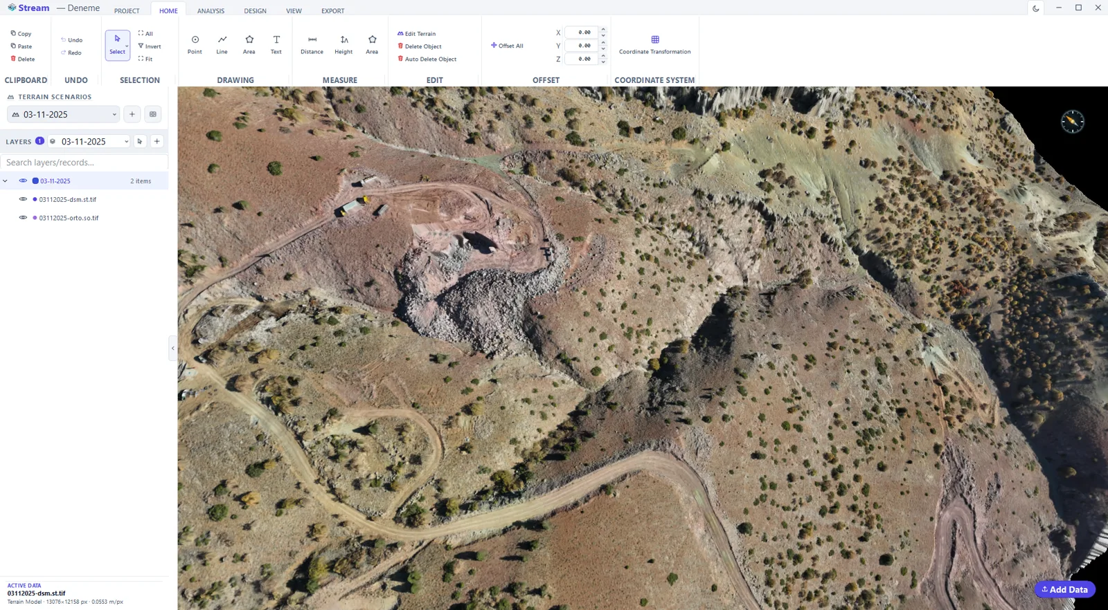
What is a DEM (Digital Elevation Model)?
A Digital Elevation Model (DEM) is a raster grid where each cell stores a ground elevation. It is the base layer for almost every terrain workflow — volumes, cross-sections, slope, hydrology and contours are all derived from it.
A DEM (bare-earth) is often distinguished from a DSM (Digital Surface Model, which includes buildings and vegetation) and a DTM (Digital Terrain Model). STREAM opens all of them and computes on the elevation surface directly.
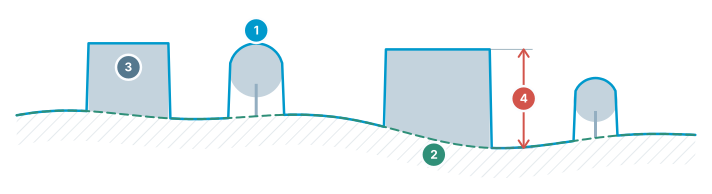
DEM / DSM / DTM
Three different surfaces of the same terrain — which one to use, at a glance.
- DSM — top surface — includes buildings, trees and structures
- DTM / DEM — bare earth — real ground with objects removed
- Objects — present in the DSM, absent in the DTM
- Difference = object height — building/tree height comes from this gap
DEM Viewer in STREAM
Stream gigabyte DEMs
Out-of-core streaming loads only the area you are looking at in full detail, so hundreds of MB — even GB — of DEM open without lag.
GPU terrain rendering
A Vulkan compute raycaster renders the elevation surface in 2D and 3D at full resolution, with shaded relief and color ramps.
Measure & compute on the DEM
Distance, area, elevation, cut/fill volume, cross-sections and stockpiles are all measured directly from the DEM surface.
Analyze the terrain
Run slope, aspect, viewshed, hydrology, contour and sun & shadow analysis on the DEM and save the results as raster or vector.
In the product
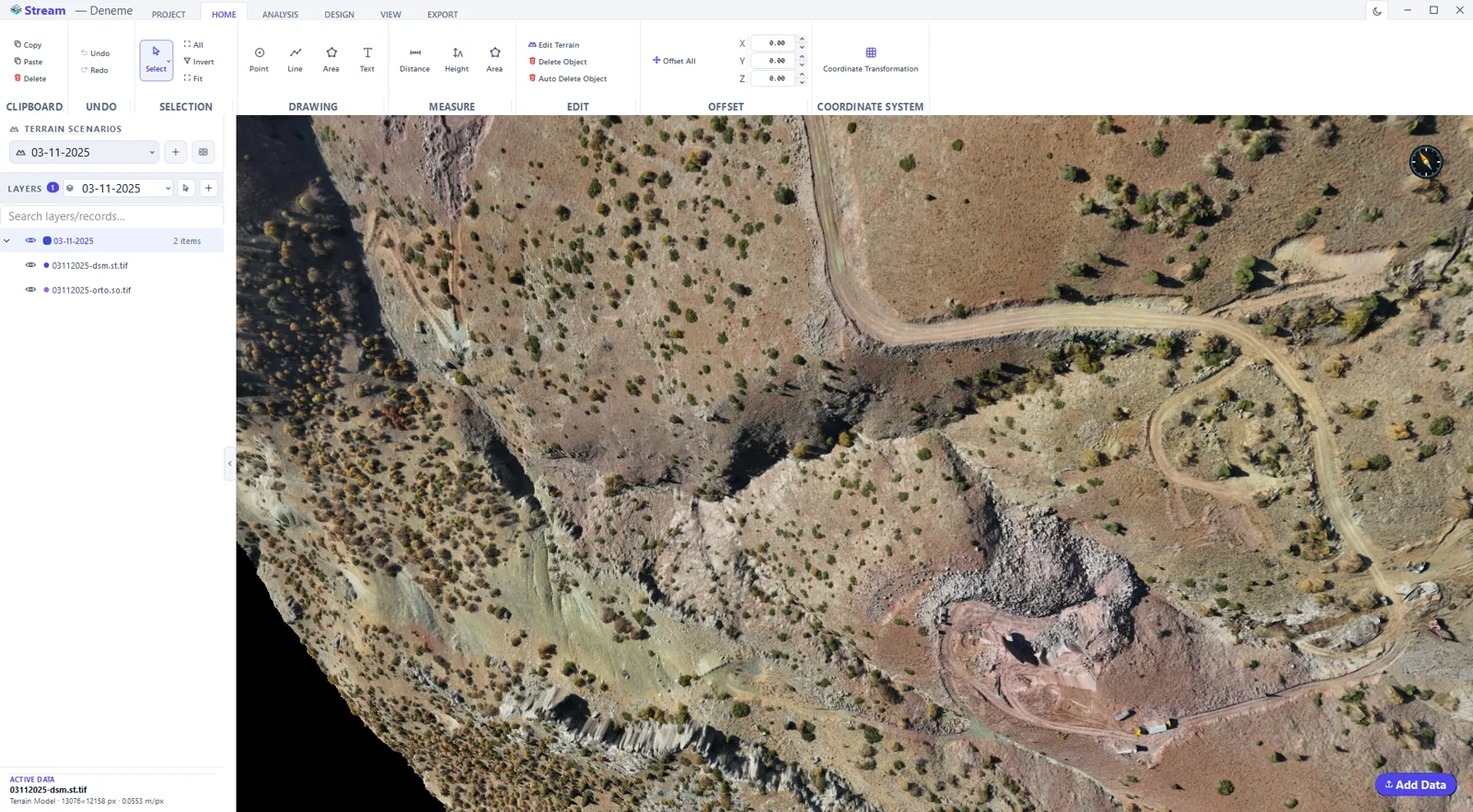
How to open and work with a large DEM
- 1
Load the file
Pick the GeoTIFF (or ASC) from the load dialog. STREAM reads the format, detects that it is an elevation raster and shows the progress as a task card.
- 2
Confirm the coordinate system
Check the CRS STREAM read from the file before the layer is added to the project, so every later measurement lands in the right place.
- 3
Let the cache build
On first load the DEM is converted to a fast native cache. That is why the same project reopens in seconds afterwards.
- 4
Navigate
Use fit-to-data to frame everything, switch between 2D and 3D, and read X/Y/Z under the cursor as you move.
- 5
Measure or analyse
Draw a point, line or area on the surface and apply a measurement, a volume calculation or an analysis to that geometry.
Supported formats
Frequently asked questions
What DEM file formats does STREAM support?
STREAM opens GeoTIFF elevation rasters, ESRI ASCII grids (.asc) and common DEM grids, and can rasterize LAS/LAZ point clouds into a DEM on import.
How large a DEM can STREAM open?
STREAM is built for gigabyte-scale DEMs. It streams data out-of-core and converts it to a fast internal format on first load, so large models stay responsive and reopen in seconds.
Does STREAM work offline?
Yes. STREAM runs entirely on your computer; the DEM never leaves your machine and no internet connection is required.
Is STREAM digital elevation model software or a full GIS?
Digital elevation model software, deliberately. STREAM opens and streams the DEM, derives slope, aspect, hillshade, contours, hydrology, viewshed and sun-shadow from it, and measures volumes and cross-sections on it. It does not try to be a general-purpose GIS: thematic mapping, attribute databases and cartographic layouts stay in your GIS, and STREAM hands its results over as GeoTIFF, DXF, CSV and KMZ.
Is STREAM DEM processing software?
For the work done on a DEM once it exists, yes: stream it at full resolution, derive slope, aspect, hydrology, viewshed and contours, edit the surface, convert its vertical reference with a geoid grid, and export the results as GeoTIFF, DXF or KMZ.
How do I open a DEM file?
Open the GeoTIFF in STREAM like any other layer. A single-band elevation raster becomes terrain, the coordinate system embedded in the file is shown for confirmation before the layer joins the project, and the DEM streams out-of-core, so a gigabyte file opens without being loaded whole. The first load writes a fast internal cache next to the source, which is why the second open takes seconds.
Can I clip a DEM to a polygon?
Yes. Draw the area, select the DEM or orthophoto and run Raster Clip: everything outside the area is hidden, and no new file is written. The clip sits as its own record under the layer, so you can switch it off with its eye or undo it. Analyses and volumes can also be limited to a drawn area without clipping the raster at all.
Is STREAM a free DEM viewer?
STREAM is a Windows 10/11 (x64) desktop application, and during the open beta it is free with every feature unlocked. It opens a DEM from a national program, a global dataset or your own survey and works offline. Tiles published in latitude and longitude open with a warning — distances, areas and volumes need a projected system, so convert them to one such as UTM before measuring.
Where this is used
Try DEM Viewer in STREAM
Free beta for Windows x64. Works fully offline with GeoTIFF, LAS/LAZ and DXF.
Download STREAM free