CONTOURS
Contour Line Generation Software from a DEM
STREAM is contour line generation software: it generates contour lines directly from your DEM at the interval you choose, and saves them as clean, editable vectors. Trace a single elevation or produce a full contour set for a topographic map.
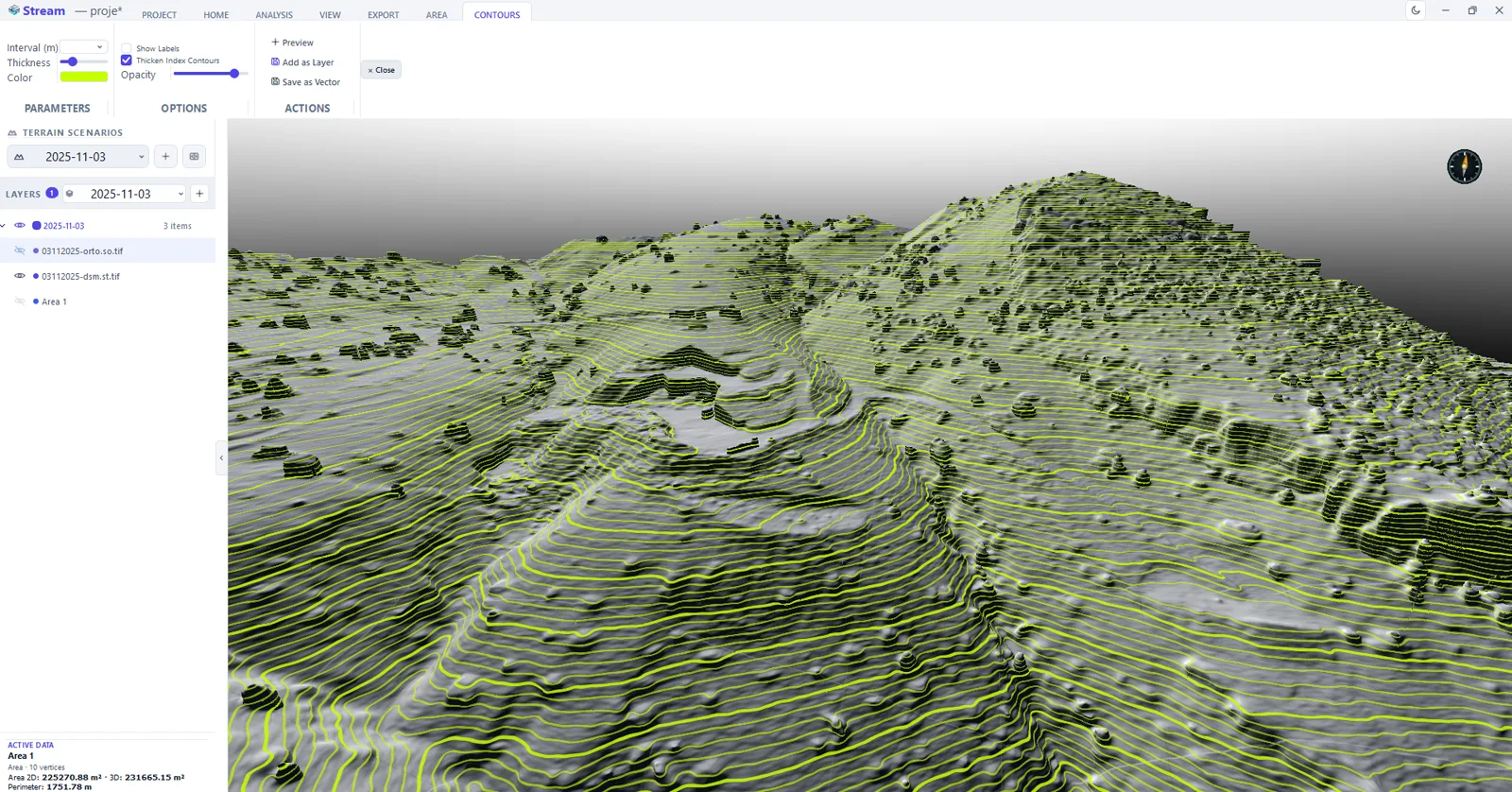
What are contour lines?
Contour lines connect points of equal elevation. They are the classic way to read terrain shape on a topographic map and a standard deliverable for survey and civil projects.
Because they are derived from the DEM, the interval and smoothness can be tuned to suit the map scale.
Contour Line Generation Software in STREAM
Contours at any interval
Generate a full contour set at the interval you choose, computed directly from the DEM.
Follow a single elevation
Trace the contour of one chosen elevation as an area or line with a single action.
Editable vector output
Save contours as vector data and export to DXF for CAD and mapping.
On the real terrain
Contours follow the DEM surface, so they match the ground you loaded.
Interval, index lines and labels
Pick the interval from the list or type your own — 1, 2.5, 5 and 10 m in metric, 2, 5, 10 and 25 ft in imperial. Every fifth line is drawn as an index line at 2.2× the width by default, elevation labels can be switched on, and the line width, colour and transparency apply live without regenerating anything.
Preview before you commit
Preview draws the contours over the terrain with their labels without adding anything to the layer tree. When they look right, Add as Layer makes them a permanent layer that is saved with the project and toggled with the eye icon.
Contours as editable line objects
Save as Vector converts the contours into real line objects: they can be edited, snapped to, measured, styled and exported to DXF like anything else you drew. That is the difference between a picture of contours and contours you can hand to a surveyor.
In the product
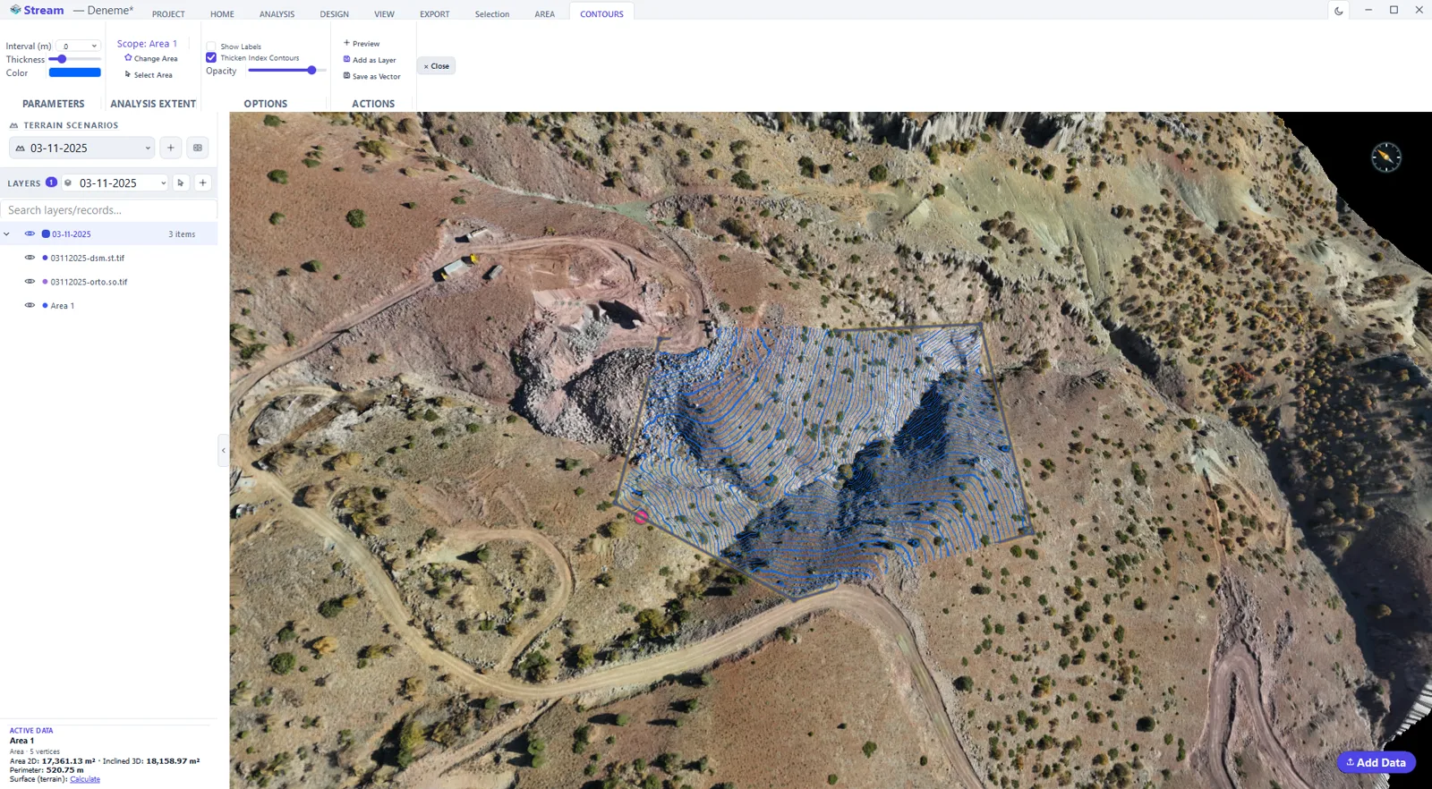
How to generate contour lines from a DEM
- 1
Set the scope
Draw or select the area the contours are generated inside, so the calculation runs on the part of the site you care about.
- 2
Set the interval
Enter the contour interval and the index interval for the heavier labelled lines.
- 3
Preview on the terrain
The contours are drawn over the surface straight away; change the interval and look again before committing.
- 4
Keep the result
Add the contours to the project as a vector layer so they persist with the scenario.
- 5
Export
Send the contour vectors to DXF for CAD, or include them in a map sheet.
Supported formats
Frequently asked questions
Can I choose the contour interval?
Yes. STREAM generates contours at the interval you set, computed directly from the DEM, and can also trace a single chosen elevation.
What format are contours exported in?
Contours are saved as editable vector data and exported to DXF for CAD and topographic mapping.
Are contours generated from the DEM?
Yes. Contours follow the DEM surface, so they match the real terrain you loaded.
What contour interval should I choose?
The interval is offered as an editable list — 1, 2.5, 5 and 10 m in metric units, 2, 5, 10 and 25 ft in imperial — and you can type any value. Choose it from the relief and the purpose: a flat site needs a fine interval to say anything, and a mountainous one becomes unreadable at the same value.
What is an index contour?
Every fifth line, drawn thicker so the eye can count elevations without reading every label. STREAM enables it by default at 2.2× the normal width, and you can turn it off or change the line width, colour and transparency — those apply immediately, without regenerating the contours.
Why don't my labels appear?
Labels are drawn on generated contour geometry, not on the raw terrain, so run Preview first — or Add as Layer. Until the contours exist as geometry there is nothing for a label to sit on.
Can I export contours to DXF or edit them?
Yes. Save as Vector turns the contours into line objects, which are editable, snappable, measurable and exportable to DXF along with the rest of your vectors. A layer added by Add as Layer is a display layer; the vector conversion is what makes them drawing data.
Is there a resolution limit on contour generation?
Contours are generated on a grid of at most 4096 pixels. This limit is independent of the slope-measurement base setting under Analysis, so changing that does not change the contour resolution.
Can I get contours of a design surface rather than the ground?
Yes — that is the usual mining and civil case. Apply a graded design or a pit surface to the terrain, then generate contours; they follow whatever surface is current, so you get contours of the design rather than of the survey it replaced.
Can I make a topographic map from a DEM or a point cloud?
Yes. A LAS/LAZ point cloud is first turned into a DEM; then show the contours over the DEM, hillshade or orthophoto and send the view to a map sheet: A4, A3 or A2, portrait or landscape, fitted automatically or at a fixed 1:1,000, 1:2,000, 1:5,000 or 1:10,000, printed to PDF. The contour lines themselves also export to DXF.
Can I make contours from drone data?
Yes. A drone DEM — or a surface rasterized from a LAS/LAZ point cloud — is contoured like any other DEM, at the interval you choose.
Try Contour Line Generation in STREAM
Free beta for Windows x64. Works fully offline with GeoTIFF, LAS/LAZ and DXF.
Download STREAM free