3D VIEW
3D Terrain Viewer
STREAM's 3D terrain viewer renders your DEM in a fast GPU-driven 3D view. Fly across gigabyte DEMs and orthophotos at full resolution, switch instantly between 2D and 3D, and see analysis and imagery draped on the real surface.
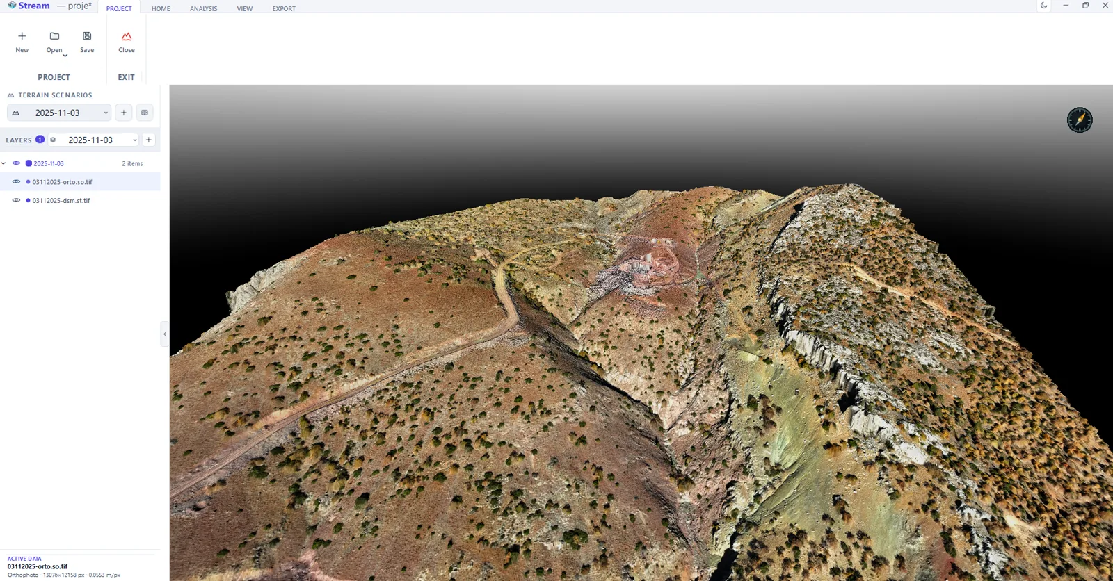
Why a real 3D view helps
A flat map hides slope and shape. Seeing the DEM in true 3D — with the orthophoto and analysis draped on it — makes the terrain immediately readable and helps spot problems a plan view misses.
STREAM's renderer is built for scale, so the 3D view stays smooth even on very large datasets.
3D Terrain Viewer in STREAM
GPU terrain rendering
A Vulkan compute renderer draws the terrain at full resolution in 3D, without dropping detail.
2D and 3D
Switch instantly between a plan (2D) view and a perspective (3D) view as the task needs.
Imagery & analysis draped
See orthophotos and analysis overlays wrapped onto the real 3D surface.
Fly-throughs
Move smoothly across the site and record fly-through views for presentation.
2D plan mode when perspective would lie
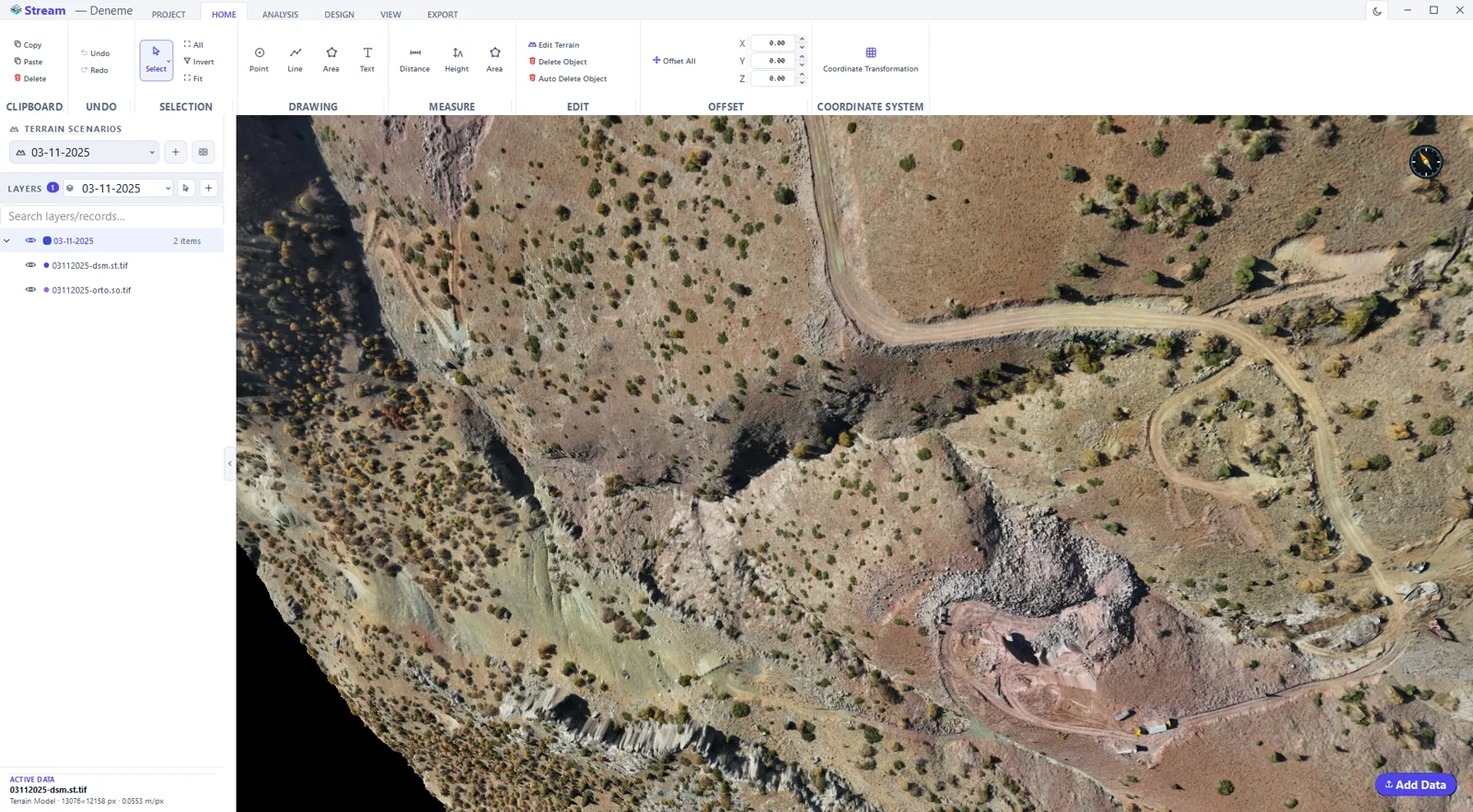
A dedicated 2D mode locks the camera straight down with no perspective, so distances and areas read correctly by eye — in 3D, perspective misleads. Switching between the two is one click on the ribbon or the status bar, and Face North and Top View reframe without changing the mode.
Navigation that anchors to the ground
The wheel zooms toward the terrain point under the cursor rather than the screen centre, arrow keys pan, Shift with the arrows orbits, and the pitch is held between just below the horizon and looking straight down. Wheel direction, zoom speed and what the left button does — pan or orbit — are all settings.
Backgrounds chosen for the deliverable
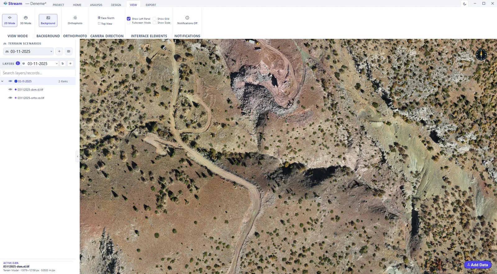
Dark grey, black, white, or a horizon gradient. A white background makes a screenshot readable in a report, and STREAM switches the guide lines and scale bar to dark ink automatically when the background is light, so nothing disappears.
Transparency on terrain is an X-ray
Layer opacity is set per record from the layer tree. On a DEM it does not fade the surface colour: below 100% the points, lines, areas and CAD geometry that sit under the terrain become visible through it — which is how you check that an imported drawing lands where it should.
Orthophoto enhancement that never touches the file
Brightness, contrast, saturation, gamma and sharpening adjust how the orthophoto looks on screen, with a reset that restores the defaults. It is a display-only adjustment: the source file and every export stay exactly as they were.
Mouse controls set to your habits
Wheel direction, zoom speed, whether the left button pans or orbits, and the orbit direction are four settings under Settings ▸ Navigation — so the view behaves like the CAD or mining package your hand already knows. Changes apply immediately, and while a drawing or measurement tool is open the left button always goes to the tool.
In the product
How to explore terrain in 2D and 3D
- 1
Frame the site
Fit to data brings every loaded and visible layer into view in one click, so you never start lost.
- 2
Choose the view mode
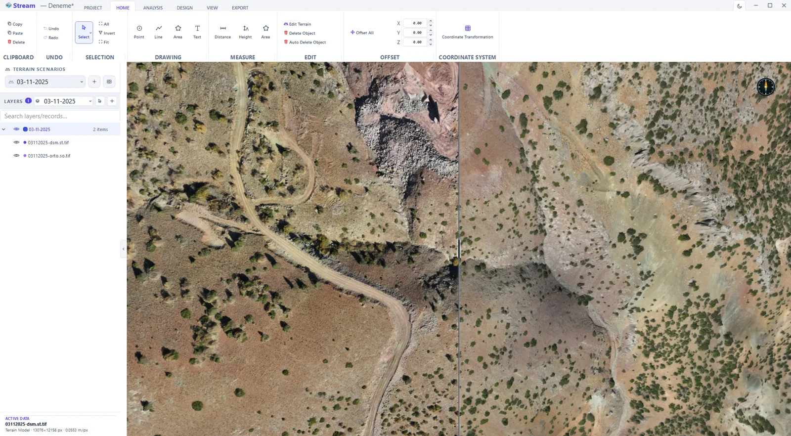
2D is the plan view for drawing, measuring and map sheets. 3D is the free camera for slopes, benches and design checks. Double-clicking the compass returns to top view.
- 3
Decide what is drawn
Turn the orthophoto on or off — with it off the terrain reads as slope-shaded grey — and manage the legend, scale bar and guides.
- 4
Navigate
Pan, zoom and orbit at full resolution; the terrain is raycast, so detail does not drop as you zoom in. The cursor shows X/Y/Z the whole time.
- 5
Record a fly-through
Set the camera path and record the movement as a video for presentation.
Watch it
Frequently asked questions
Can STREAM show terrain in 3D?
Yes. STREAM renders the DEM in a GPU-driven 3D view at full resolution, with imagery and analysis draped on the surface.
Can I switch between 2D and 3D?
Yes. STREAM switches instantly between a 2D plan view and a 3D perspective view.
Does the 3D view work on large data?
Yes. The renderer streams gigabyte DEMs and orthophotos and keeps the 3D view smooth at full detail.
When should I use 2D mode instead of 3D?
Whenever you are judging distance or area by eye. 2D mode locks the camera straight down with no perspective, so what you see is the plan; in 3D, perspective foreshortens and makes the far side of a pit look shorter than it is.
How does zooming work?
The wheel zooms toward the terrain point under the cursor, not toward the centre of the screen, so you keep the feature you are looking at. Speed and wheel direction are settings, and the keyboard plus and minus keys use the same factor.
Can I change what the mouse buttons do?
Yes. By default the left button pans and the middle orbits, and a setting swaps them if you prefer left-drag to orbit. The right button cancels the active tool and is not part of the swap.
Why does my terrain look grey with no image on it?
Because no orthophoto is loaded for that area. Without one, STREAM shades the DEM by slope in grey — flat ground light, steep faces dark — independently of any light direction, so the relief is readable. Add an orthophoto and it is draped over the same surface.
Can I see CAD lines that sit under the terrain?
Yes, by lowering the layer's opacity. On a DEM, transparency behaves like an X-ray rather than a fade: below 100% the points, lines, areas and imported CAD geometry beneath the surface show through, which is the quickest way to check that a drawing landed in the right place.
Can I brighten a dark orthophoto?
Yes, with the on-screen enhancement: brightness, contrast, saturation, gamma and sharpening, each with a reset. It changes only what is drawn — the source GeoTIFF and every export are untouched, so nobody downstream receives an image you adjusted for your own screen.
What background should I use for a report screenshot?
White. STREAM offers dark grey, black, white and two horizon gradients, and when you pick a light background it automatically switches the guide lines and the scale bar to dark ink so they stay legible on the printed page.
Where this is used
Related reading
Try 3D Terrain Viewer in STREAM
Free beta for Windows x64. Works fully offline with GeoTIFF, LAS/LAZ and DXF.
Download STREAM free