MEASUREMENT
Terrain Measurement Software
STREAM's terrain measurement software turns your terrain into a precise measuring surface: read real-world distance, area and elevation, and compute volumes, straight on the DEM with instant results — no export, no round trip.
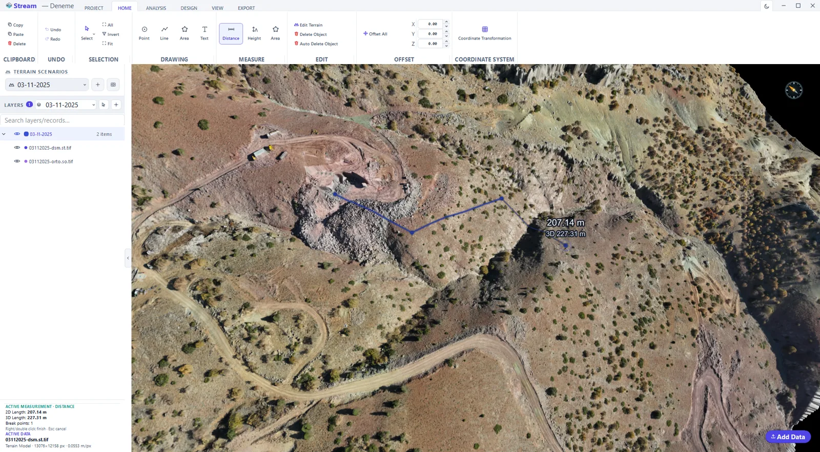
Measuring on the terrain
Because the DEM is georeferenced, every measurement STREAM makes is in real-world units and follows the actual ground surface, not a flat screen projection.
That means a distance drapes over hills, an area follows the terrain, and an elevation difference reflects the true height change.
Measurement Software in STREAM
Distance
Measure real-world distance between two or more points, following the terrain surface.
Area
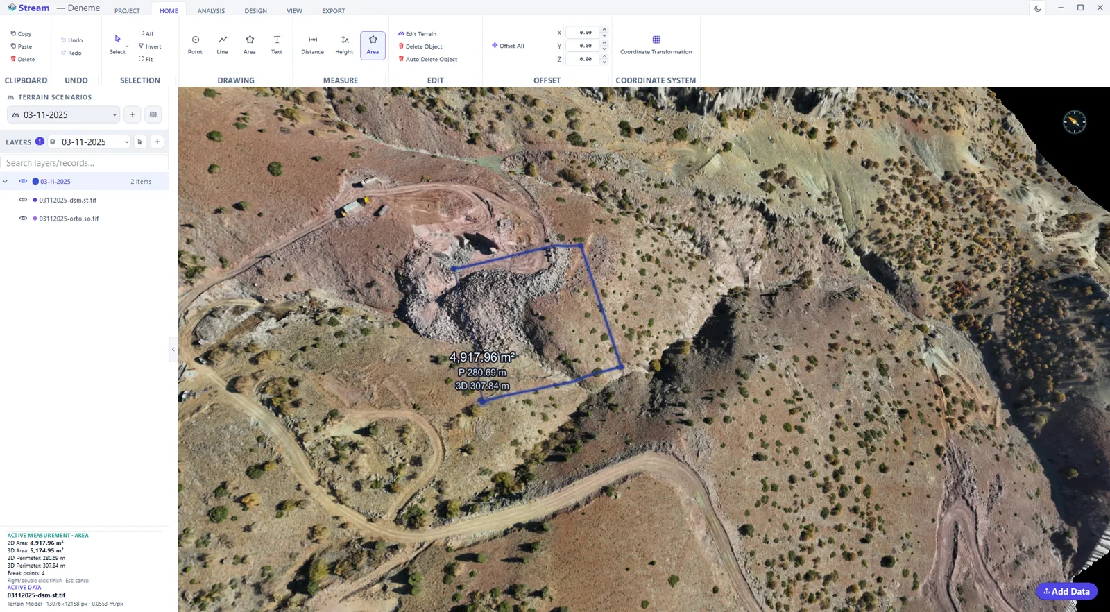
Measure the surface area of closed regions, with the result shown instantly on screen.
Elevation & height difference
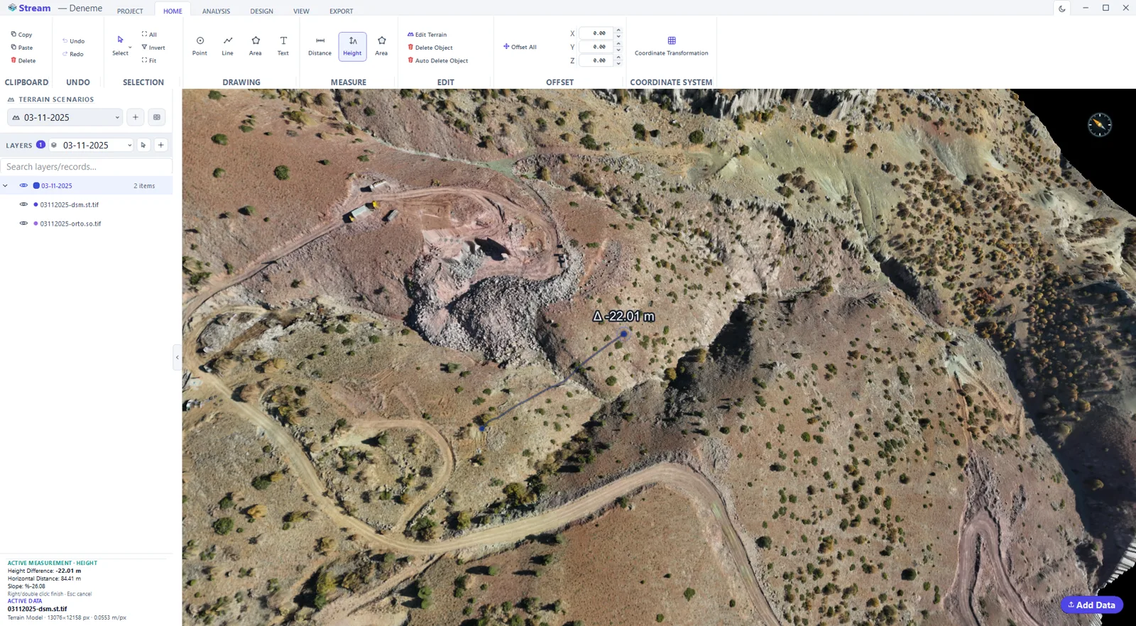
Read the elevation at any point and the height difference between any two points instantly.
Volume
Go beyond simple measures with cut/fill and stockpile volumes computed on the same surface.
Plan, 3D and surface length
The distance tool reports three values at once: the 2D plan length, the 3D length along the draped surface, and the vertex count — so a haul road or a fence line is measured the way it is built, not the way it looks on a map.
Grade triangle
The height tool reads the elevation of two points off the terrain and draws a grade triangle between them: vertical and horizontal legs, the height difference, and the slope in percent and degrees. It finishes by itself after the second point.
Plan, 3D and draped area
The area tool reports the 2D plan area, the 3D area of the inclined plane, the 3D surface area draped on the terrain, and the 2D and 3D perimeters — the numbers a bench, a pad or a slope face actually needs.
In the product
How to measure on the terrain
- 1
Load the surface
Open the DEM, or a surface derived from a point cloud. Every measurement is taken off that surface, not off a flat plan.
- 2
Pick the measurement
Distance gives horizontal and true surface length with the elevation difference and the slope; height gives the vertical difference between two points; area gives plan area and perimeter; profile gives a section along a line.
- 3
Click on the terrain
Left click adds a vertex, double click or right click finishes, Esc cancels. Ctrl+Z steps back through the whole drawing and measurement history.
- 4
Read the values
Results appear on the geometry and in the side panel, in the units set for the project.
- 5
Keep them
Measurements are saved with the project, so they come back with the scenario and can be exported with the drawing.
Watch it
Frequently asked questions
Are measurements in real-world units?
Yes. Because the DEM is georeferenced, distance, area and elevation are measured in real-world units and follow the actual terrain.
Do results appear instantly?
Yes. STREAM shows measurement results on screen as you draw, with no export step.
Can I switch between metric and imperial?
Yes. STREAM supports metric and imperial units with one-click switching.
What is the difference between 2D, 3D and surface length?
2D length is measured on the flat plan. 3D length follows the line draped on the terrain, so it is longer on sloping ground. STREAM shows both together so you do not have to measure twice.
How is the slope between two points shown?
The height tool draws a grade triangle on the view: the vertical and horizontal legs, the height difference Δh and the slope as a percentage at the middle of the chord. The side panel lists Δh, the horizontal distance and the slope.
Can a measurement snap to DXF geometry?
Yes. A measurement vertex can snap to a DXF vertex, a line vertex or a point. When it does, it takes that geometry's own elevation instead of reading the terrain.
Can I draw an elevation profile along a line?
Yes. Select a line drawn on the terrain and click Profile: the Section Profile panel plots the ground under it at 1:1 and lists the distance, minimum and maximum elevation, average slope, total ascent and descent and 3D length. Add Terrain Scenario overlays a second survey on the same line, and Export writes the profile as a CSV table or a DXF drawing.
Where this is used
Try Measurement in STREAM
Free beta for Windows x64. Works fully offline with GeoTIFF, LAS/LAZ and DXF.
Download STREAM free