SURFACE ANALYSIS
Slope & Aspect Analysis from a DEM
STREAM's slope analysis software turns your DEM into clear slope and aspect maps. See surface steepness on a color scale, find which way slopes face, and save the result as a live overlay, a raster or a vector layer.
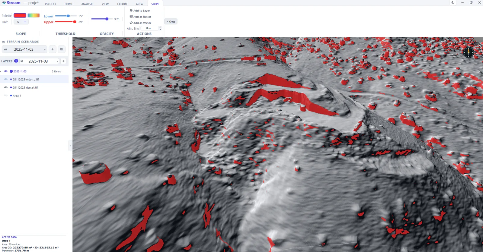
What is slope and aspect analysis?
Slope measures how steep the terrain is at each point; aspect measures the direction a slope faces. Both are derived from the DEM and are fundamental inputs for siting, drainage, agriculture and hazard work.
Viewing them as a color layer over the terrain makes patterns obvious that raw elevation hides — this is terrain steepness mapping from a DEM, not geotechnical slope-stability (factor-of-safety) analysis.
Slope Analysis Software in STREAM
Slope color map
Visualize steepness across the whole DEM on a color scale, as a live overlay on the terrain.
Aspect direction
See which direction each slope faces, isolate specific directions, and read it on a compass legend.
More terrain analysis
Alongside slope and aspect, run viewshed, line-of-sight, hydrology, contours and sun & shadow on the same DEM.
Save the output
Keep results as a live overlay or export them as raster (GeoTIFF) or vector.
In the product
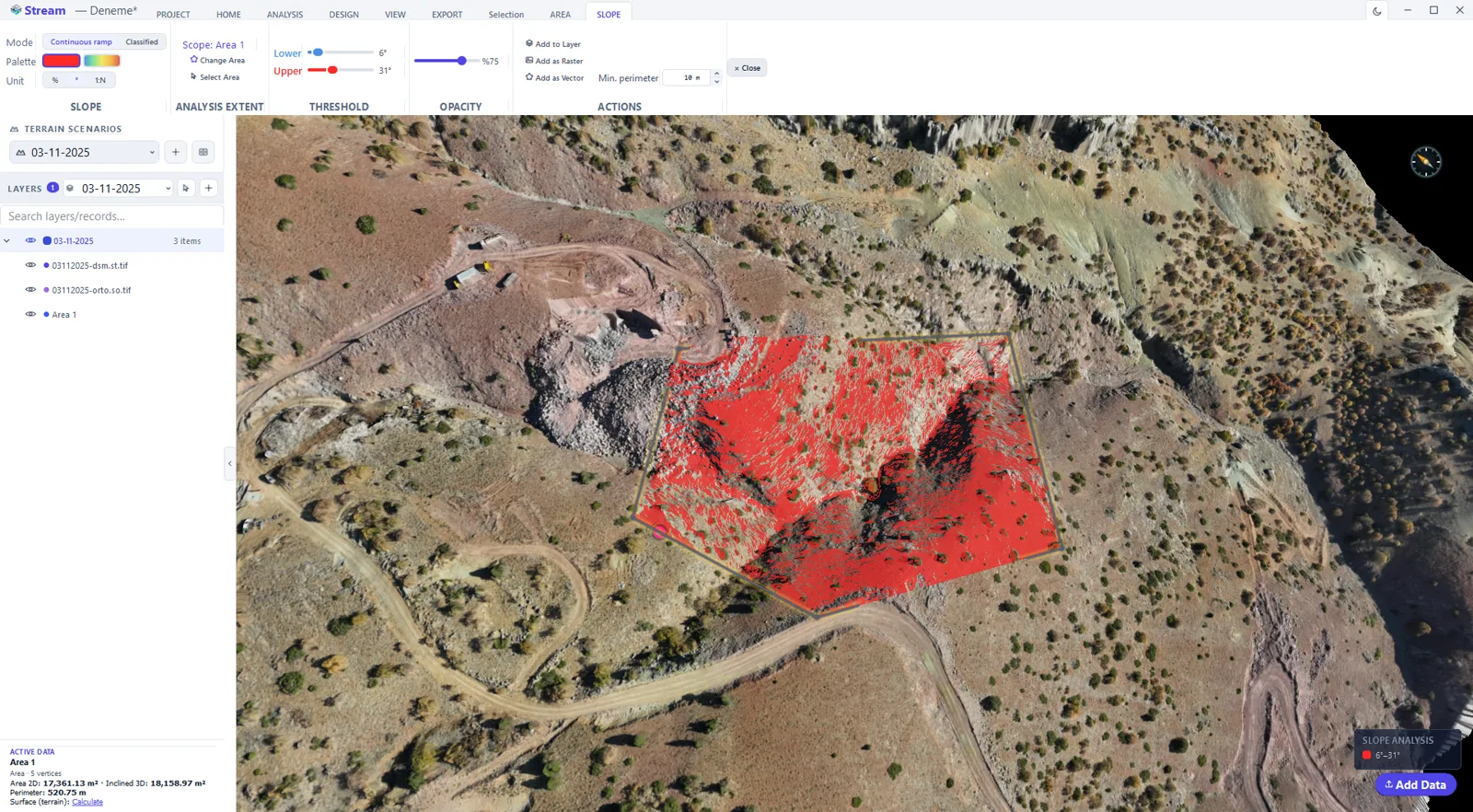
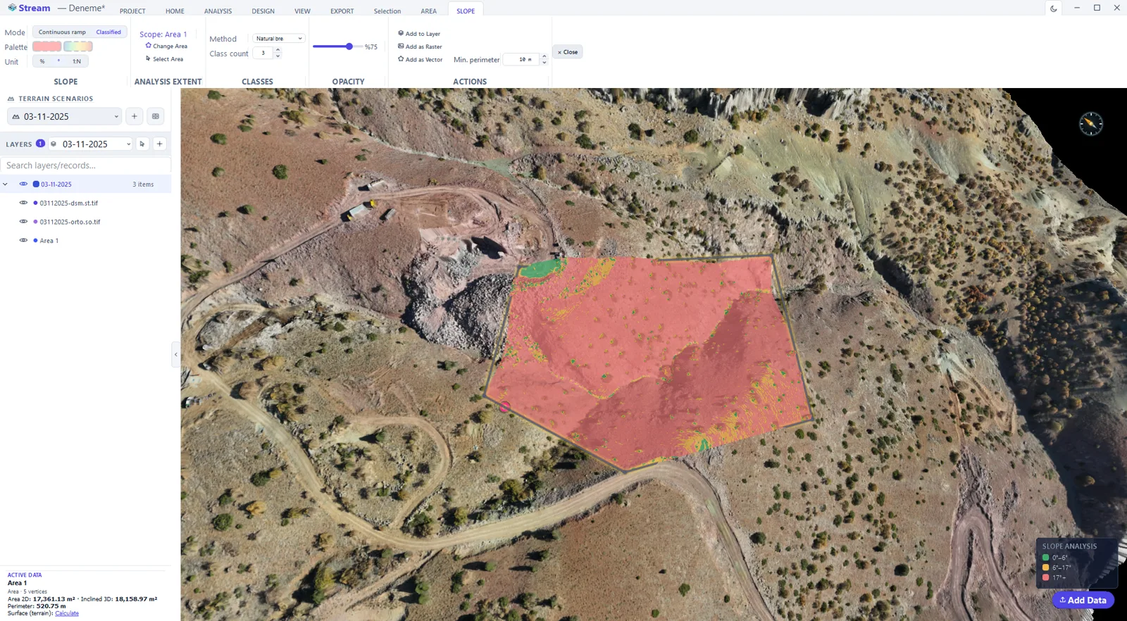
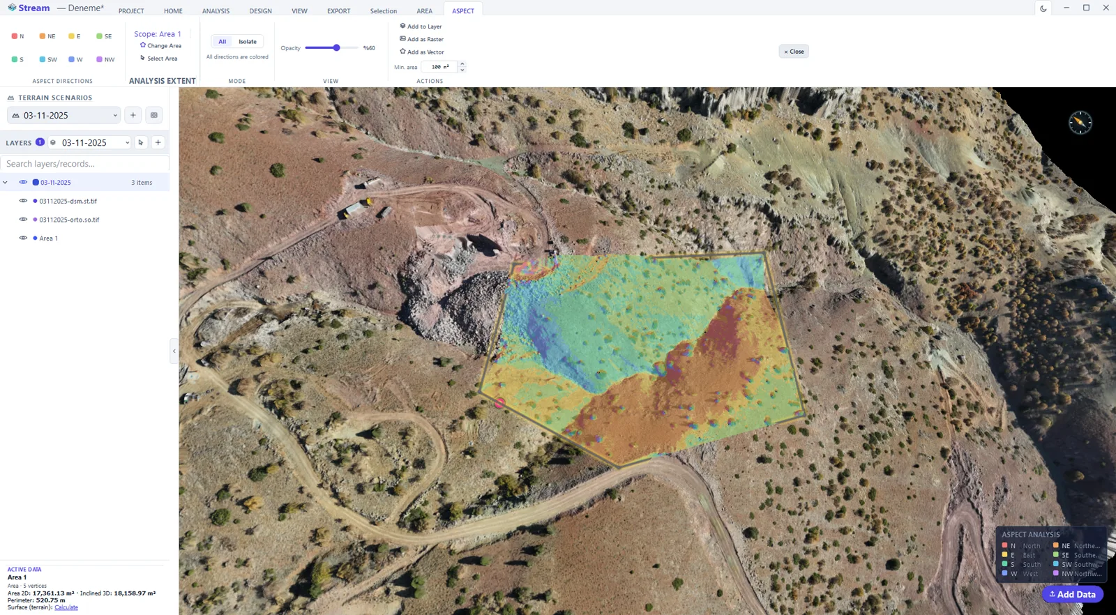
How to produce a slope map from a DEM
- 1
Set the scope
Draw or select the area to analyse. Every analysis in STREAM runs inside the selected area rather than silently over the whole raster.
- 2
Choose slope or aspect
Slope answers how steep the ground is; aspect answers which way it faces. Both come off the same surface.
- 3
Set the class breaks
Enter the thresholds that matter for the job — equipment limits, safety bands, or design slopes — and pick the colour ramp.
- 4
Read the result
The map is painted over the terrain with a legend, and you can change the breaks and look again before saving anything.
- 5
Keep or export
Add the result as a layer, or export it as a GeoTIFF raster or a vector for GIS and CAD.
Supported formats
Watch it
Frequently asked questions
Is slope computed from the DEM?
Yes. Slope and aspect are computed directly from the DEM surface and shown as a color overlay on the terrain.
Can I export slope and aspect results?
Yes. Results can be kept as a live overlay or exported as raster (GeoTIFF) or vector layers.
What other analyses does STREAM offer?
Viewshed, line-of-sight, hydrology, contour generation, sun & shadow and change detection — all on the same DEM.
How do I make a slope map from a DEM?
Load the DEM and switch on slope analysis: STREAM computes the steepness of every cell and draws the slope map as a colour overlay on the terrain, with aspect available the same way. Keep it as a live overlay, or export the slope map as a GeoTIFF raster or as vector.
Where this is used
Try Slope Analysis in STREAM
Free beta for Windows x64. Works fully offline with GeoTIFF, LAS/LAZ and DXF.
Download STREAM free