VISIBILITY
Viewshed Analysis Software — Visibility & Line-of-Sight
STREAM is viewshed analysis software that computes visibility directly on your DEM. Place an observer and see exactly which ground is visible and which is hidden, or check whether an obstacle blocks the line of sight between two points.
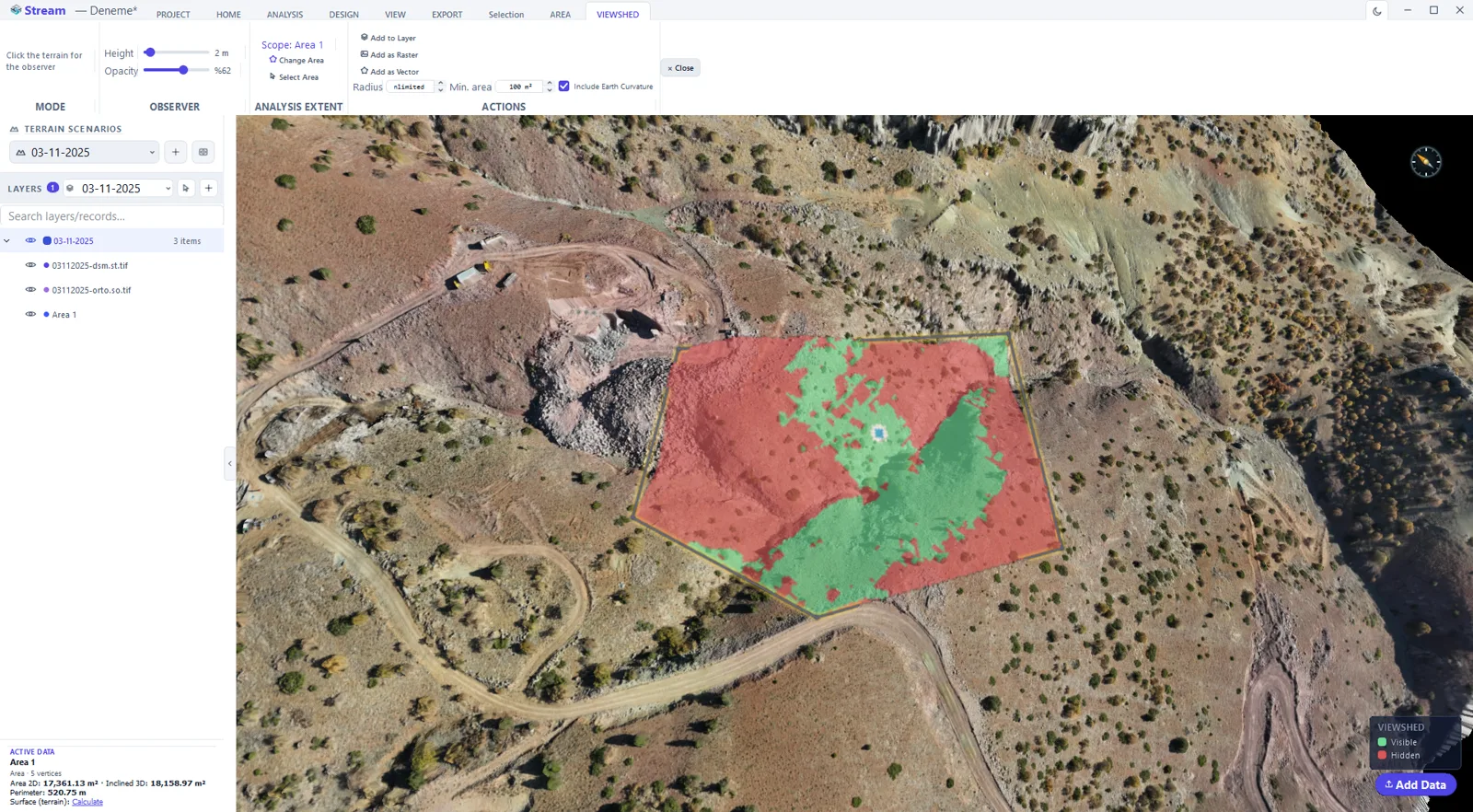
What is a viewshed?
A viewshed is the area of terrain visible from a given observer point, computed from the elevation surface. Line-of-sight is the related question of whether two specific points can see each other.
Both are essential for telecom siting, surveillance, planning, and any task where visibility over terrain matters.
Viewshed Analysis Software in STREAM
Viewshed from a point
See visible and hidden ground from a selected observer, as a clear color overlay on the terrain. Set the observer's height above ground (1–30 m) and an optional maximum search radius.
Line of sight
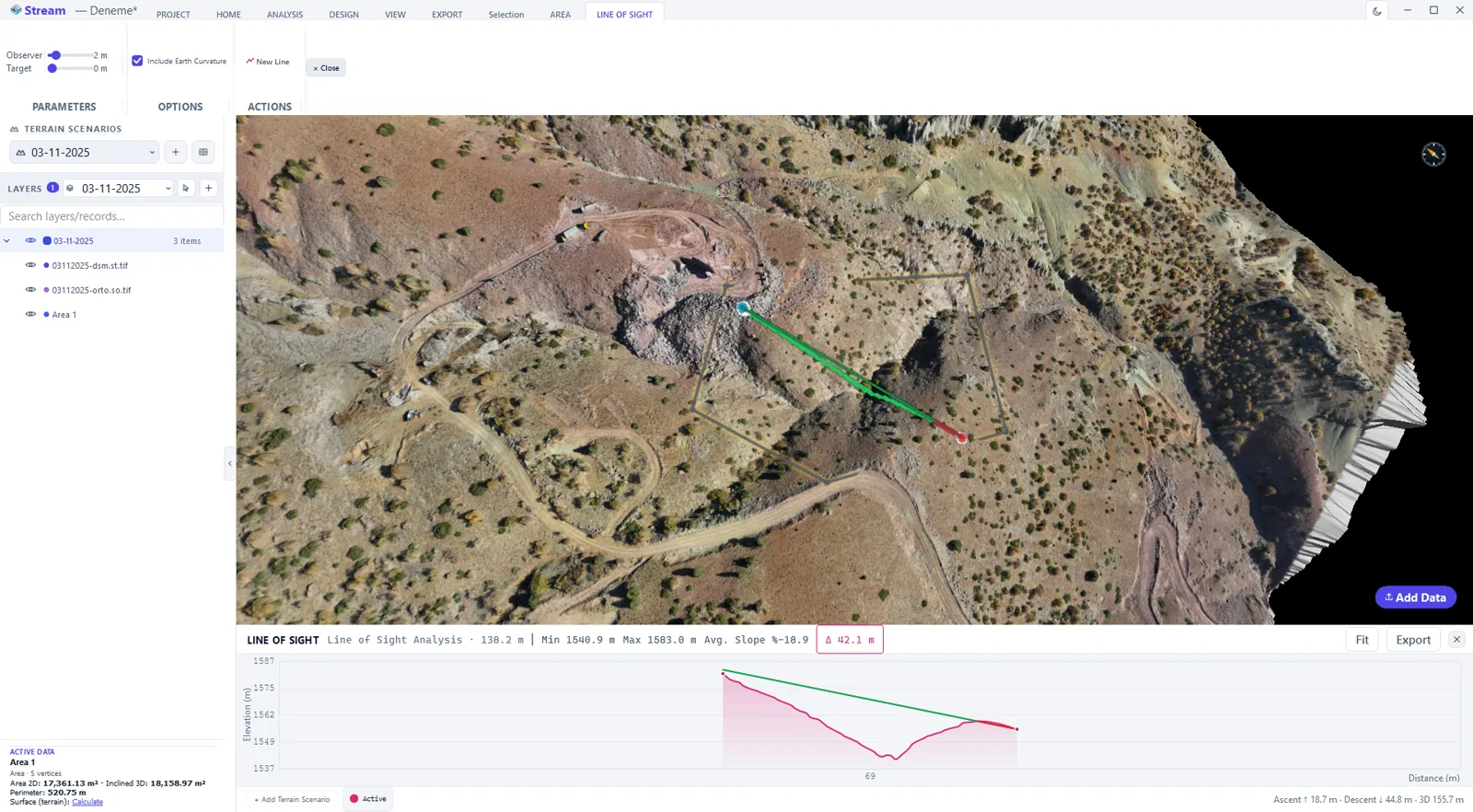
Check instantly whether an obstacle blocks the line between two points, with independent observer and target height offsets and an earth-curvature-and-refraction correction for long lines of sight.
Runs on the DEM
Visibility is computed from the real elevation surface you loaded, at the DEM's own resolution, so results reflect the actual terrain.
Save the result
Keep the viewshed as a live overlay or export it as raster or vector.
In the product
How to run a viewshed analysis
- 1
Set the scope
Draw or select the area the visibility is computed inside.
- 2
Place the observer
Put the observer point on the terrain and enter its height above the ground — a camera mast, a tower, or eye height.
- 3
Set the range
Enter the radius the analysis reaches and the target height that has to be visible.
- 4
Read the result
Visible and hidden ground is painted over the terrain. For a single pair of points, the line-of-sight profile shows exactly where the obstruction is.
- 5
Keep or export
Add the viewshed as a layer, or export it as a raster or a vector for the report.
Supported formats
Frequently asked questions
What can I do with viewshed analysis in STREAM?
See which ground is visible or hidden from an observer point, and check line-of-sight between two points — computed directly on the DEM.
Is viewshed useful for telecom or security?
Yes. Viewshed and line-of-sight are standard tools for antenna siting, surveillance coverage and planning over terrain.
Can I export the viewshed?
Yes. Results can be kept as a live overlay or exported as raster or vector for reports and GIS.
Try Viewshed Analysis in STREAM
Free beta for Windows x64. Works fully offline with GeoTIFF, LAS/LAZ and DXF.
Download STREAM free