CHANGE DETECTION
Terrain Change Detection Software
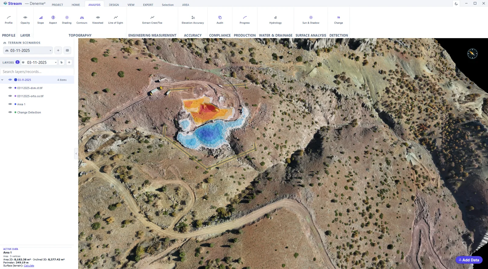
STREAM's terrain change detection software compares two surveys and reports what changed between them — where material was added or removed, the net volume with an uncertainty band, and only the change that is statistically significant. Ideal for tracking mining, earthworks and erosion over time.
What is change detection?
Change detection measures the difference between two elevation surfaces captured at different times. Beyond a raw difference map, a rigorous result reports volume with an uncertainty band and filters out change smaller than the survey noise.
STREAM uses a level-of-detection threshold (LoD) and optional co-registration to correct systematic shift between the two datasets, so the reported change is trustworthy.
This process — often called a DEM of Difference (DoD) — is the standard method for quantifying surface change between repeat topographic surveys.
Change Detection Software in STREAM
Deposition & erosion
See where material was added (deposition) and removed (erosion) as a clear color map between two scenarios.
Volume ± uncertainty
Get net cut/fill volume with an uncertainty band, not just a single unqualified number.
Level of detection (LoD)
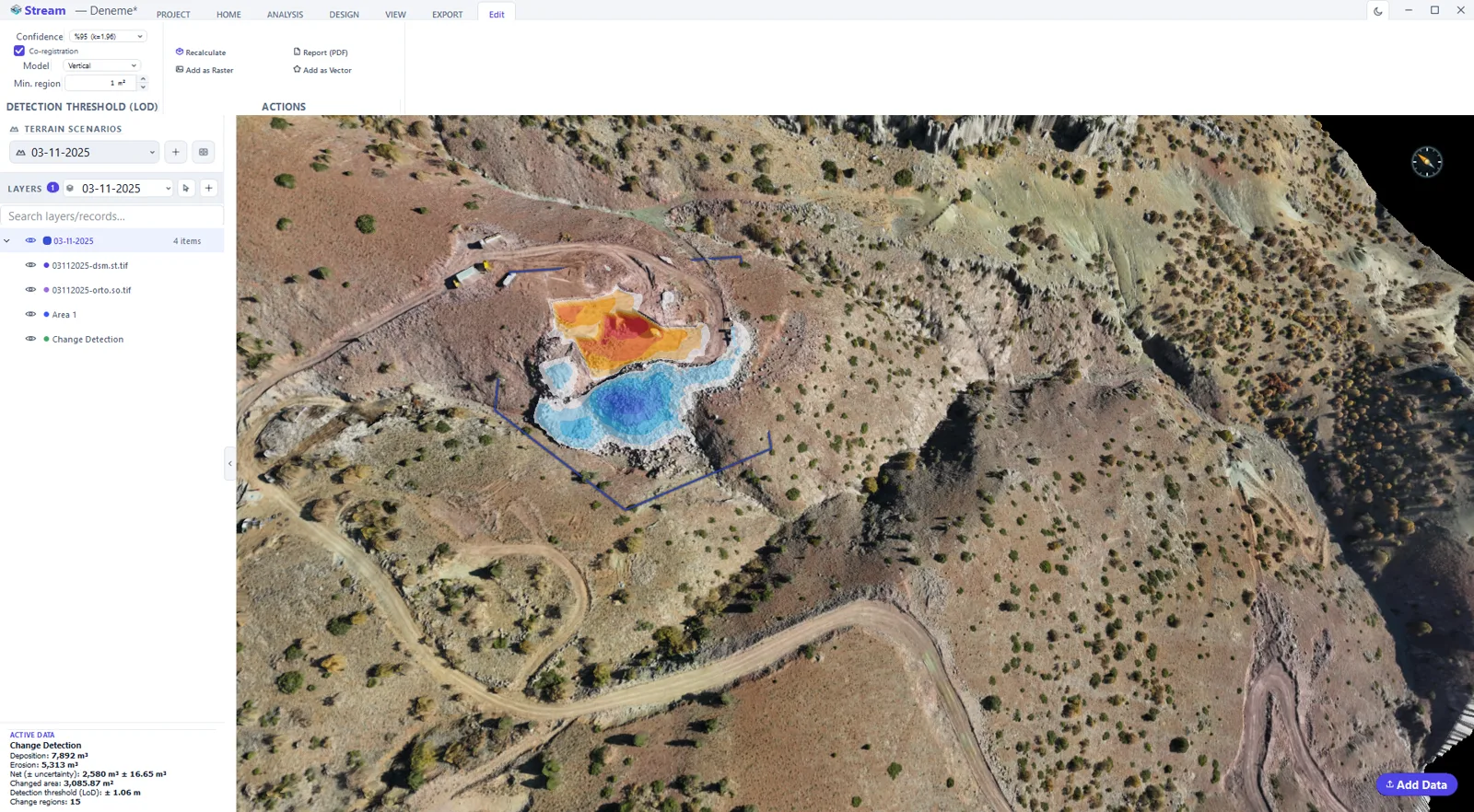
Choose a confidence level so only change larger than the survey noise is kept as significant.
Co-registration & reports
Correct systematic vertical shift between datasets, and export a PDF report plus raster/vector change layers.
Where teams use it
Stockpile volume reconciliation at mine sites, quarry and pit production tracking, earthworks and construction progress verification, and coastal or riverbank erosion monitoring over time.
Split-screen curtain comparison
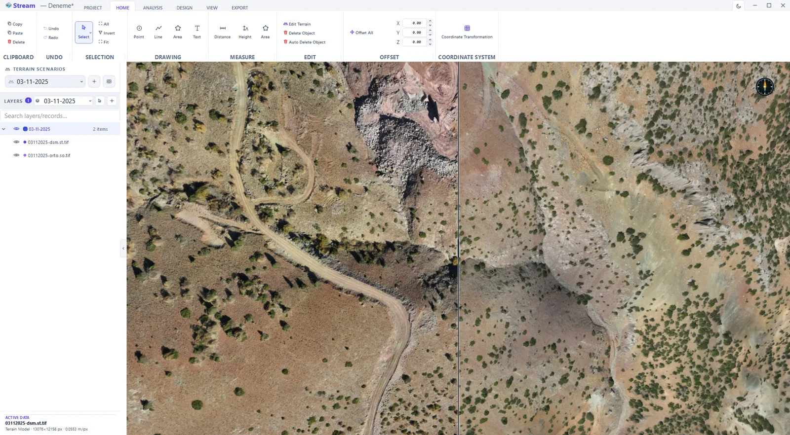
Put one survey on the left and another on the right: Compare Mode splits the view with a curtain you drag anywhere between 5% and 95% of the screen, and the B key flips instantly between the two so small differences jump out. Measurements, drawings and DXF overlays stay on the base half, and the terrain scenario is locked while the split is open.
In the product
How to detect change between two surveys
- 1
Load both surveys
Bring in the earlier and the later terrain model. Each is kept as its own scenario, so the old model is never overwritten.
- 2
Check they share a datum
Both surfaces must be in the same coordinate system and vertical datum, otherwise the difference measures the misalignment instead of the change.
- 3
Set the scope
Draw or select the area being compared — a pit, a stockpile yard, a river bank.
- 4
Set the detection threshold
Enter the level below which a difference is treated as survey noise rather than real movement.
- 5
Read and export
Gain and loss appear as a coloured map with net volume; save the map as a raster and take the figures into the PDF report.
Supported formats
Watch it
Frequently asked questions
How does STREAM detect change?
It compares two terrain scenarios and reports deposition, erosion and net volume with an uncertainty band, keeping only change above a level-of-detection threshold.
What is level of detection (LoD)?
LoD is a confidence threshold: change smaller than the combined survey noise is filtered out, so only statistically significant change is reported.
Can STREAM correct alignment between two surveys?
Yes. Optional co-registration removes systematic vertical shift (and tilt) between the two datasets before computing change.
Can I compare two surveys visually, side by side?
Yes. Compare Mode takes two different terrain scenarios, each with a visible DEM, and draws the base on the left and the reference on the right of a curtain you drag across the screen. It is a visual check that sits alongside the volumetric change map, not a replacement for it.
What does the B key do in Compare Mode?
It flips the whole view between the two scenarios at once. Blinking between surveys is the quickest way to spot a moved stockpile toe or a new bench by eye before measuring it.
Where this is used
Try Change Detection in STREAM
Free beta for Windows x64. Works fully offline with GeoTIFF, LAS/LAZ and DXF.
Download STREAM free